 Geobru catalogue
Regions and cities
Type of resources
Available actions
Topics
INSPIRE themes
Keywords
Contact for the resource
Provided by
Years
Formats
Representation types
Update frequencies
status
Service types
Scale
Resolution
-
Web Map Service for the BISA layers
-

This download service provides object-based access to urban planning data managed through NOVA over the territory of Brussels Region.
-
This download service provides object-based access to urban planning data managed through NOVA over the territory of Brussels Region.
-
Discovery Service (CSW) of the Geographic Metadata Catalogue for the Brussels Capital region
-
This service allows downloading of Paradigm's datasets.
-
-
This download service provides object-based access to statistical areas of the Brussels-Capital Region maintained by the Brussels institute for statistics and analysis.
-
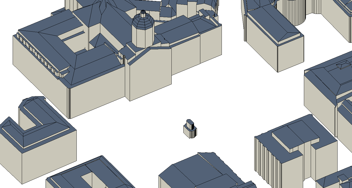
The UrbIS - Constructions 3D product corresponds to the dataset of three-dimensionally modeled buildings located in the Brussels Region. It includes both buildings and engineering structures. It comprises five classes: (1) the first corresponds to three-dimensional buildings; (2) the second to buildings' faces; (3) the third to three-dimensional engineering structures; and finally, (4) the fourth to engineering structures' faces. The dataset is freely downloadable as a zipped file.
-
This view service is maintained for Osiris backward compatibility. Please do not use for a new application.
-
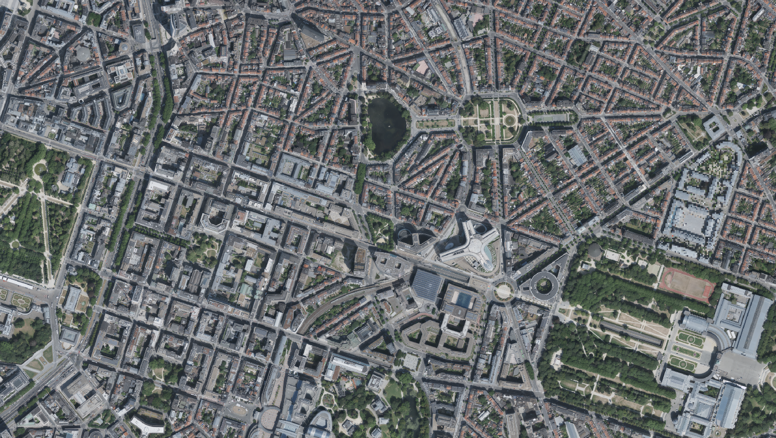
This dataset includes the RGB & NI (Red, Green, Blue and Near-Infrared) orthophotos created in 2022. The images cover the entire Brussels Capital Region, with a resolution of 5 centimeters. The dataset is freely downloadable as a zipped file.